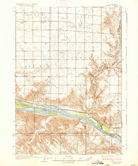
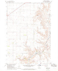
1937 Map of Canning
USGS Topo · Published 1937About this map
The Missouri River cuts a wide path through this central South Dakota landscape, shaping the development of Hughes and Stanley counties before the era of modern damming. Along the northern bank, the Chicago and Northwestern railroad dictates the placement of riverfront settlements like Canning and Rousseau, which served as vital transport links for the surrounding ranching country. The map reveals a highly organized rural infrastructure of the mid-1930s, dotted with neighborhood schools such as Good Luck Sch and Elm Grove Sch. South of the river, the Lower Brule Indian Reservation contains landmarks of spiritual and community life, including St Thomas Ch and Holy Name Chapel. Notable family-named outposts like the Seldom Seen Ranch and White Palace highlight the individual homesteading history of the Missouri breaks, while several large islands like Fort George Island remain prominent in the river channel.
Find a feature on this map
41 named features on this map. Tap any name to fly to it.
Don’t see what you’re looking for? This feature index may not catch every label — zoom into the map to look around manually.
Map Details
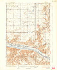
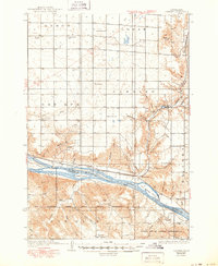
Editions of this 1937 Canning Map
3 editions found
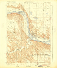
Other maps of this area
1924 · Pierre
USGS Topo · 1:62,500

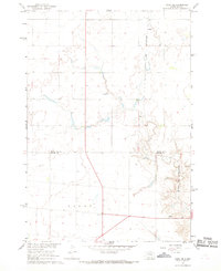
1934 · Canning
USGS Topo · 1:48,000

1953 · Huron
USGS Topo · 1:250,000

1954 · Pierre
USGS Topo · 1:250,000

1954 · Huron
USGS Topo · 1:250,000

1958 · Pierre
USGS Topo · 1:250,000

1966 · Joe Creek NW
USGS Topo · 1:24,000

1967 · Pierre NE
USGS Topo · 1:24,000
1967 · Canning
USGS Topo · 1:24,000
1967 · Onida SE
USGS Topo · 1:24,000