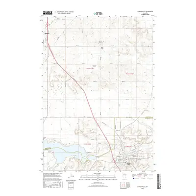
2016 Map of Cannon Falls
USGS Topo · Published 2016About this map
The Cannon River valley dominates the southern half of this landscape, where the waters widen into Lake Byllesby near the city of Cannon Falls. This area showcases a transition from the structured agricultural grid of the northern plains to the more complex topography of the river corridor. Small settlements like Hampton and New Trier are positioned along the plateau, defined by their local landmarks such as Saint Mary's Catholic Church and Saint Mary's Catholic Cem.
Find a feature on this map
85 named features on this map. Tap any name to fly to it.
Don’t see what you’re looking for? This feature index may not catch every label — zoom into the map to look around manually.
Map Details
Editions of this 2016 Cannon Falls Map
This is the sole edition of this map. No revisions or reprints were ever made.
Other maps of this area

1953 · Saint Paul
USGS Topo · 1:250,000

1957 · Farmington
USGS Topo · 1:62,500

1957 · Hastings
USGS Topo · 1:62,500

1959 · Saint Paul
USGS Topo · 1:250,000

1960 · Dennison
USGS Topo · 1:24,000

1968 · Sogn
USGS Topo · 1:24,000

1968 · White Rock
USGS Topo · 1:24,000
1974 · Coates
USGS Topo · 1:24,000
1974 · Randolph
USGS Topo · 1:24,000
1974 · Cannon Falls
USGS Topo · 1:24,000