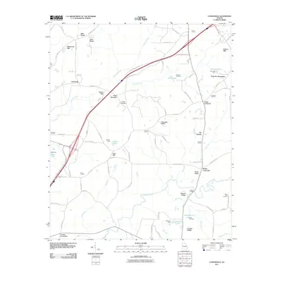
2011 Map of Cannonville
USGS Topo · Published 2011About this map
Hogg Mountain stands as a prominent topographical feature in this Georgia landscape, presiding over a transition from rural crossroads to residential developments. The area's ancestral roots are preserved in numerous family and community burial grounds, including Fannin Cemetery, Lebanon Cemetery, and Bright Star Cemetery. Traditional rural hubs like Smiths Crossroad, Baughs Crossroads, and Cottons Crossroads anchor the road network, while newer named communities such as Plantation Manor and Smoke Rise indicate the shifting character of the land. Water resources are plentiful throughout the quadrangle, with multiple small dams and reservoirs like Murphy Lake Dam and Eagle Club Dam situated along Blue John Creek, Mud Creek, and Wildcat Creek. Local history enthusiasts can find traces of earlier settlement at Old Chimney or locate the State Bridge crossing over Flat Shoal Creek.
Find a feature on this map
86 named features on this map. Tap any name to fly to it.
Don’t see what you’re looking for? This feature index may not catch every label — zoom into the map to look around manually.
Map Details
Editions of this 2011 Cannonville Map
This is the sole edition of this map. No revisions or reprints were ever made.
Other maps of this area

1899 · Wedowee
USGS Topo · 1:125,000

1902 · Wedowee
USGS Topo · 1:125,000

1907 · Talbotton
USGS Topo · 1:125,000

1907 · Opelika
USGS Topo · 1:125,000

1909 · Opelika
USGS Topo · 1:125,000

1953 · Atlanta
USGS Topo · 1:250,000

1955 · Phenix City
USGS Topo · 1:250,000

1957 · Phenix City
USGS Topo · 1:250,000

1957 · Atlanta
USGS Topo · 1:250,000

1958 · Phenix City
USGS Topo · 1:250,000