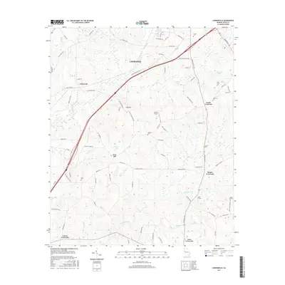
2017 Map of Cannonville
USGS Topo · Published 2017About this map
LaGrange and its rural southern hinterlands are defined by a network of crossroads settlements and family burial grounds in this Troup County landscape. The area is anchored by historic junctions such as Baughs Crossroads, Smiths Crossroad, and Cottons Crossroads, which served as local hubs for the surrounding agricultural community. Significant local landmarks include Hogg Mtn and the Grayhill Airport, while numerous family cemeteries like Fannin Cem, Bethel Cem, and Oak Grove Cem provide essential data points for genealogical research. The hydrology of the region is dominated by Flat Shoal Creek and Long Cane Cr, with several small impoundments such as Murphy Lake and Zachery Lake dotting the terrain. This survey provides a clear view of the transition from the city of LaGrange to the quiet, creek-fed woods of Cannonville and beyond.
Find a feature on this map
86 named features on this map. Tap any name to fly to it.
Don’t see what you’re looking for? This feature index may not catch every label — zoom into the map to look around manually.
Map Details
Editions of this 2017 Cannonville Map
This is the sole edition of this map. No revisions or reprints were ever made.
Other maps of this area

1899 · Wedowee
USGS Topo · 1:125,000

1902 · Wedowee
USGS Topo · 1:125,000

1907 · Talbotton
USGS Topo · 1:125,000

1907 · Opelika
USGS Topo · 1:125,000

1909 · Opelika
USGS Topo · 1:125,000

1953 · Atlanta
USGS Topo · 1:250,000

1955 · Phenix City
USGS Topo · 1:250,000

1957 · Phenix City
USGS Topo · 1:250,000

1957 · Atlanta
USGS Topo · 1:250,000

1958 · Phenix City
USGS Topo · 1:250,000