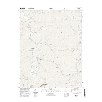
2016 Map of Canoe
USGS Topo · Published 2016About this map
The Middle Fork River winds through the hills of Breathitt County, anchoring a series of small riverside and hollow-based settlements in this 2016 survey. Communities like Canoe, Talbert, and Crockettsville are connected by narrow roads that follow the complex topography of the Cumberland Plateau. Much of the southern portion of the map is protected within the Daniel Boone National Forest, where the terrain is defined by numerous named hollows such as Onionpen Hollow, Jackson Hollow, and Pigeonroost Hollow. Notable landmarks like Nailors Rock and the drainage of Sebastians Branch provide geographical context for this section of eastern Kentucky. The settlement pattern remains closely tied to the watercourses, with places like Whick, Wolf Coal, and Altro situated along the eastern margins and rail routes, reflecting the region's historical reliance on river and valley corridors for transportation.
Find a feature on this map
47 named features on this map. Tap any name to fly to it.
Don’t see what you’re looking for? This feature index may not catch every label — zoom into the map to look around manually.
Map Details
Editions of this 2016 Canoe Map
This is the sole edition of this map. No revisions or reprints were ever made.
Other maps of this area

1889 · Salyersville
USGS Topo · 1:125,000

1891 · Manchester
USGS Topo · 1:125,000

1891 · Hazard
USGS Topo · 1:125,000

1891 · Salyersville
USGS Topo · 1:125,000

1892 · Beattyville
USGS Topo · 1:125,000

1899 · Salyersville
USGS Topo · 1:125,000

1913 · Buckhorn
USGS Topo · 1:62,500

1951 · Quicksand
USGS Topo · 1:24,000

1951 · Jackson
USGS Topo · 1:24,000

1952 · Tallega
USGS Topo · 1:24,000