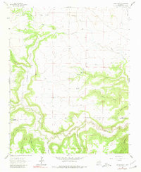
1964 Map of Canon Ancho
USGS Topo · Published 1980About this map
Paltenghe Ranch sits as a primary point of human activity within this high-desert landscape of canyons and seasonal drainages on the border of Mora and San Miguel counties. The terrain is defined by the deep carving of Cañon Ancho and the meandering path of the Mora River, which flows through the southern portion of the quadrangle. A network of names such as Agua Chiquito and Cañon Encinoso reflect the region's cultural heritage, while features like Vega Sixtysix and Sixty-six Creek hint at early grazing lands and land divisions.
Find a feature on this map
25 named features on this map. Tap any name to fly to it.
Don’t see what you’re looking for? This feature index may not catch every label — zoom into the map to look around manually.
Map Details
Editions of this 1964 Canon Ancho Map
2 editions found
Other maps of this area

1892 · Watrous
USGS Topo · 1:125,000

1894 · Watrous
USGS Topo · 1:125,000

1954 · Santa Fe
USGS Topo · 1:250,000

1958 · Santa Fe
USGS Topo · 1:250,000

1964 · Frutosa Lake
USGS Topo · 1:24,000

1964 · Mogote Hills
USGS Topo · 1:24,000

1964 · Alamosa Creek
USGS Topo · 1:24,000

1964 · Canon Ancho
USGS Topo · 1:24,000

1971 · Alamito
USGS Topo · 1:24,000

1971 · Canon Las Cuevas
USGS Topo · 1:24,000