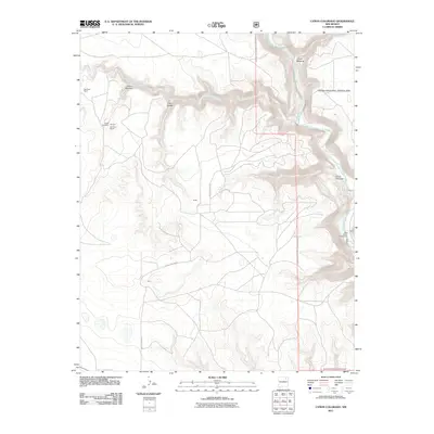
2011 Map of Canon Colorado
USGS Topo · Published 2011About this map
Kiowa National Grassland dominates this high plains landscape, where the dramatic incision of the Canadian River has carved a series of deep canyons through Harding County. The rugged topography is defined by major breaks like Cañon Colorado and Cañon Biscante, which provided natural shelter and water access for early ranching operations. Traces of local history are preserved at the Países Cemetery and established ranching sites such as Red River Ranch and the Monroe Red River Ranch. The map captures a transition between the open range and the steep canyon walls, where Arroyo Piedra Lumbre feeds into the primary river system. Small crossroads and named locales like Kates and Horn are linked by Miles Canyon Rd, reflecting the sparse but enduring settlement patterns of northeastern New Mexico. Outdoor recreational history is anchored by the Mills Canyon Campground, situated where the river bend creates a significant break in the plateau.
Find a feature on this map
14 named features on this map. Tap any name to fly to it.
Don’t see what you’re looking for? This feature index may not catch every label — zoom into the map to look around manually.
Map Details
Editions of this 2011 Canon Colorado Map
This is the sole edition of this map. No revisions or reprints were ever made.
Other maps of this area

1892 · Watrous
USGS Topo · 1:125,000

1894 · Watrous
USGS Topo · 1:125,000

1954 · Santa Fe
USGS Topo · 1:250,000

1954 · Raton
USGS Topo · 1:250,000

1958 · Raton
USGS Topo · 1:250,000

1958 · Santa Fe
USGS Topo · 1:250,000

1964 · Stony Lake
USGS Topo · 1:24,000

1964 · Alto De Hormiga
USGS Topo · 1:24,000

1964 · Alamosa Creek
USGS Topo · 1:24,000

1971 · Abbott Lake
USGS Topo · 1:24,000