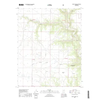
2020 Map of Canon Colorado
USGS Topo · Published 2020About this map
Kiowa National Grassland dominates the southeastern quadrant of this terrain, where the high plains of New Mexico are dissected by a complex system of drainage canyons. The Canadian River cuts through the northeast, fed by seasonal watercourses like the Arroyo Piedra Lumbre. The map reveals a landscape defined by its naming conventions, with family names attached to deep topographical features such as Cañon Juan Maestas, Cañon Monnet, and Cañon Valdez. Human presence is sparse, centered on the Paises Cem and the winding Mills Canyon Rd. This geography suggests a history of ranching and remote settlement where survival depended on the shelter and intermittent water found within the walls of Cañon Colorado and its neighboring breaks.
Find a feature on this map
21 named features on this map. Tap any name to fly to it.
Don’t see what you’re looking for? This feature index may not catch every label — zoom into the map to look around manually.
Map Details
Editions of this 2020 Canon Colorado Map
This is the sole edition of this map. No revisions or reprints were ever made.
Other maps of this area

1892 · Watrous
USGS Topo · 1:125,000

1894 · Watrous
USGS Topo · 1:125,000

1954 · Santa Fe
USGS Topo · 1:250,000

1954 · Raton
USGS Topo · 1:250,000

1958 · Raton
USGS Topo · 1:250,000

1958 · Santa Fe
USGS Topo · 1:250,000

1964 · Stony Lake
USGS Topo · 1:24,000

1964 · Alto De Hormiga
USGS Topo · 1:24,000

1964 · Alamosa Creek
USGS Topo · 1:24,000

1971 · Abbott Lake
USGS Topo · 1:24,000