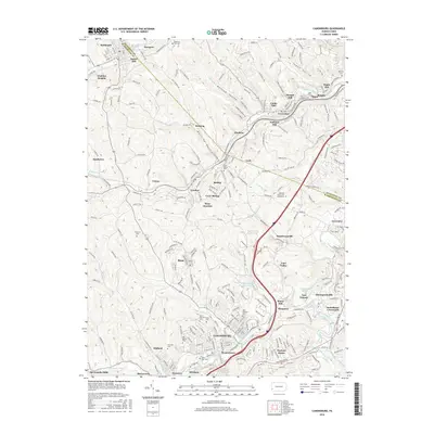
2016 Map of Canonsburg
USGS Topo · Published 2016About this map
Canonsburg and the surrounding townships of Washington County reflect a landscape shaped by coal-era rail lines and deep-cut valleys. The terrain is defined by winding watercourses like Chartiers Creek and Millers Run, which historical development followed through tight corridors such as Sygan Hollow and Reissing Hollow. The northern portion of the map is marked by the industrial and transport footprints of the P & W V RR and settlements like Sturgeon and Gladden.
Find a feature on this map
268 named features on this map. Tap any name to fly to it.
Don’t see what you’re looking for? This feature index may not catch every label — zoom into the map to look around manually.
Map Details
Editions of this 2016 Canonsburg Map
This is the sole edition of this map. No revisions or reprints were ever made.
Other maps of this area

1901 · Amity
USGS Topo · 1:62,500

1904 · Amity
USGS Topo · 1:62,500

1904 · Carnegie
USGS Topo · 1:62,500

1904 · Burgettstown
USGS Topo · 1:62,500

1906 · Burgettstown
USGS Topo · 1:62,500

1906 · Carnegie
USGS Topo · 1:62,500

1907 · Claysville
USGS Topo · 1:62,500

1908 · Carnegie
USGS Topo · 1:62,500

1948 · Pittsburgh West
USGS Topo · 1:24,000
1951 · Pittsburgh West
USGS Topo · 1:24,000