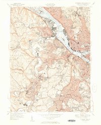
1951 Map of Pittsburgh West
USGS Topo · Published 1951About this map
The confluence of the Allegheny River and Monongahela River forms the head of the Ohio River, anchoring an industrial landscape defined by river traffic and rail networks. This mid-century survey illustrates the dense residential expansion into the hills south and west of the city, where neighborhoods like Dormont, Mount Lebanon, and Crafton sit atop the winding topography. Along the banks, the P and L E RR and Pennsylvania RR follow the water, serving industrial hubs near McKees Rocks and Neville Island.
Find a feature on this map
94 named features on this map. Tap any name to fly to it.
Don’t see what you’re looking for? This feature index may not catch every label — zoom into the map to look around manually.
Map Details
Editions of this 1951 Pittsburgh West Map
3 editions found
Other maps of this area

1904 · Mc Keesport
USGS Topo · 1:62,500

1904 · Carnegie
USGS Topo · 1:62,500

1906 · Carnegie
USGS Topo · 1:62,500

1906 · Sewickley
USGS Topo · 1:62,500

1907 · Pittsburg
USGS Topo · 1:62,500

1908 · Sewickley
USGS Topo · 1:62,500

1908 · Carnegie
USGS Topo · 1:62,500

1908 · New Kensington
USGS Topo · 1:62,500

1910 · New Kensington
USGS Topo · 1:62,500

1948 · Pittsburgh West
USGS Topo · 1:24,000