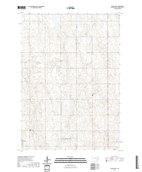
2021 Map of Canova East
USGS Topo · Published 2021About this map
Canova sits at the southwestern edge of this landscape, situated on the high glacial upland of the Coteau des Prairies. This region is defined by its distinct prairie potholes and small depressions that dot the terrain between the north-flowing drainages of the Little Vermillion River and the W Fork Vermillion River. The map reveals a strictly organized section-line road grid, including 233rd St and 441st Ave, which facilitated the agricultural settlement of Miner County. For those researching local family history, the map precisely locates the Pleasant Hill Cem and Canova Cem, serving as critical landmarks for the rural community's heritage in the early twenty-first century.
Find a feature on this map
27 named features on this map. Tap any name to fly to it.
Don’t see what you’re looking for? This feature index may not catch every label — zoom into the map to look around manually.
Map Details
Editions of this 2021 Canova East Map
This is the sole edition of this map. No revisions or reprints were ever made.
Other maps of this area

1899 · Alexandria
USGS Topo · 1:125,000

1899 · De Smet
USGS Topo · 1:125,000

1953 · Watertown
USGS Topo · 1:250,000

1955 · Sioux Falls
USGS Topo · 1:250,000

1958 · Sioux Falls
USGS Topo · 1:250,000

1958 · Watertown
USGS Topo · 1:250,000

1968 · Oldham SW
USGS Topo · 1:24,000

1968 · Oldham SE
USGS Topo · 1:24,000

1971 · Howard
USGS Topo · 1:24,000
1971 · Winfred
USGS Topo · 1:24,000
Featured Places
- Canova, SD
- Vermillion Township, SD
- Shannon Hutterite Colony, SD
- Howard Township, SD
- Clearwater Township, SD