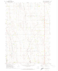
1971 Map of Canova East
USGS Topo · Published 1974About this map
The town of Canova and its surrounding agricultural township borders define this 1971 study of Miner County. This prairie landscape is primarily shaped by the meandering paths of the West Fork Vermillion River and the Little Vermillion River, which drain south through the glacial till. The town itself serves as a local hub, anchored by the C M St P & P railroad line running through the northeastern corner. Local history is anchored by the Canova Cem and the Union Ch, while the presence of scattered Gravel Pits points to the local extraction industry supporting road development during this era of rural South Dakota growth.
Find a feature on this map
12 named features on this map. Tap any name to fly to it.
Don’t see what you’re looking for? This feature index may not catch every label — zoom into the map to look around manually.
Map Details
Editions of this 1971 Canova East Map
This is the sole edition of this map. No revisions or reprints were ever made.
Other maps of this area

1899 · Alexandria
USGS Topo · 1:125,000

1899 · De Smet
USGS Topo · 1:125,000

1953 · Watertown
USGS Topo · 1:250,000

1955 · Sioux Falls
USGS Topo · 1:250,000

1958 · Sioux Falls
USGS Topo · 1:250,000

1958 · Watertown
USGS Topo · 1:250,000

1968 · Oldham SW
USGS Topo · 1:24,000

1968 · Oldham SE
USGS Topo · 1:24,000

1971 · Howard
USGS Topo · 1:24,000
1971 · Winfred
USGS Topo · 1:24,000
Featured Places
- Canova, Canova Township
- Howard Township, SD
- Shannon Hutterite Colony, Clearwater Township
- Vermillion Township, SD
- Canova Township, SD