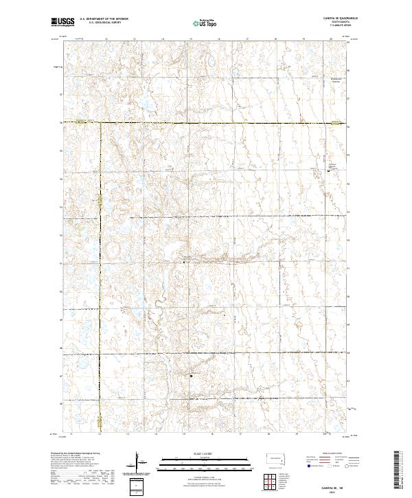
2021 Map of Canova SE
USGS Topo · Published 2021About this map
The Coteau des Prairies plateau defines the eastern edge of this agricultural landscape in McCook County, where the high prairie begins to slope away. This 2021 survey shows a geometric grid of rural roads, such as 243rd St and 435th Ave, which carve through the farmland and cross the meandering path of Wolf Cr. The map preserves the locations of several important community landmarks that are vital for local history and genealogical research. These include the Immanuel Lutheran Church Cem in the northeast, as well as the Pleasant Hill Cem and Hillside Cem further south. The convergence of Miner, Hanson, and McCook county boundaries across the northern and western sections of the quadrangle illustrates the intersection of jurisdictional lines in this rural South Dakota territory.
Find a feature on this map
27 named features on this map. Tap any name to fly to it.
Don’t see what you’re looking for? This feature index may not catch every label — zoom into the map to look around manually.
Map Details
Editions of this 2021 Canova SE Map
This is the sole edition of this map. No revisions or reprints were ever made.
Other maps of this area

1899 · Alexandria
USGS Topo · 1:125,000

1955 · Sioux Falls
USGS Topo · 1:250,000

1958 · Sioux Falls
USGS Topo · 1:250,000

1964 · Salem
USGS Topo · 1:24,000
1971 · Canova East
USGS Topo · 1:24,000

1971 · Unityville
USGS Topo · 1:24,000

1973 · Farmer
USGS Topo · 1:24,000

1973 · Canova SE
USGS Topo · 1:24,000
1973 · Spencer
USGS Topo · 1:24,000
1973 · Bitter Lake
USGS Topo · 1:24,000
Featured Places
- Edgerton Township, SD
- Rock Creek Township, SD
- Canova Township, SD
- Pearl Township, SD
- Benton Township, SD