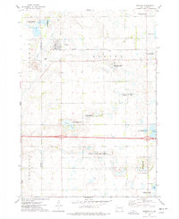
1973 Map of Spencer
USGS Topo · Published 1978About this map
The town of Spencer serves as the central hub of this eastern South Dakota landscape, situated along the Chicago and North Western railroad line. The settlement is flanked by Lakeside Cem and Spencer Cem, providing significant landmarks for genealogical research in McCook and Hanson counties. The surrounding prairie is defined by a complex network of wetlands and conservation areas, including the National Waterfowl Production Area and several state public shooting grounds like Lehrman Slough State Public Shooting Area.
Find a feature on this map
25 named features on this map. Tap any name to fly to it.
Don’t see what you’re looking for? This feature index may not catch every label — zoom into the map to look around manually.
Map Details
Editions of this 1973 Spencer Map
This is the sole edition of this map. No revisions or reprints were ever made.
Other maps of this area

1899 · Alexandria
USGS Topo · 1:125,000

1955 · Sioux Falls
USGS Topo · 1:250,000

1958 · Sioux Falls
USGS Topo · 1:250,000

1964 · Salem
USGS Topo · 1:24,000

1964 · Bridgewater East
USGS Topo · 1:24,000

1971 · Unityville
USGS Topo · 1:24,000

1973 · Spencer SW
USGS Topo · 1:24,000

1973 · Farmer
USGS Topo · 1:24,000
1973 · Bridgewater West
USGS Topo · 1:24,000

1973 · Canova SE
USGS Topo · 1:24,000