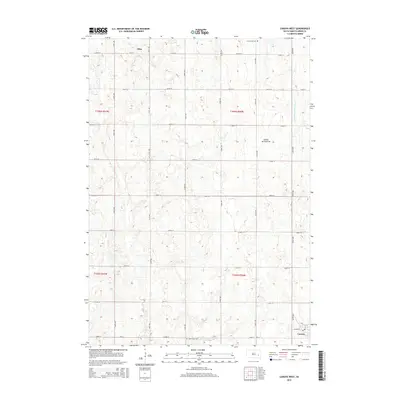
2015 Map of Canova West
USGS Topo · Published 2015About this map
Vilas and the northern outskirts of Canova anchor this section of Miner County, documenting a classic Midwestern section-line grid of rural roads and agricultural plots. The landscape is defined by the Coteau des Prairies, a high plateau that influences the local drainage patterns. Water flows through the meandering Wolf Cr in the west and the W Fork Vermillion River along the eastern margin. This 2015 survey provides a precise view of rural infrastructure, from the intersecting paths of 430th Ave and 242nd St to preserved local landmarks. Genealogists and local historians can pinpoint the locations of Saint Pauls Cem and Graceland Cem, which serve as permanent markers of the area's early settlement history amidst the evolving modern landscape.
Find a feature on this map
28 named features on this map. Tap any name to fly to it.
Don’t see what you’re looking for? This feature index may not catch every label — zoom into the map to look around manually.
Map Details
Editions of this 2015 Canova West Map
This is the sole edition of this map. No revisions or reprints were ever made.
Other maps of this area

1899 · Alexandria
USGS Topo · 1:125,000

1899 · De Smet
USGS Topo · 1:125,000

1953 · Watertown
USGS Topo · 1:250,000

1955 · Sioux Falls
USGS Topo · 1:250,000

1958 · Sioux Falls
USGS Topo · 1:250,000

1958 · Watertown
USGS Topo · 1:250,000

1968 · Oldham SW
USGS Topo · 1:24,000

1971 · Howard
USGS Topo · 1:24,000
1971 · Canova East
USGS Topo · 1:24,000

1971 · Unityville
USGS Topo · 1:24,000