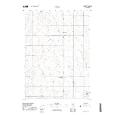
2017 Map of Canova West
USGS Topo · Published 2017About this map
Canova and Vilas anchor this rural landscape in Miner County, where the transition between the rolling hills of the Coteau des Prairies and the surrounding plains is marked by a complex network of glacial wetlands and depressions. The town of Canova occupies the southeastern corner, with street names like Railroad St and South St suggesting the traditional grid layout common to small prairie railroad towns. Further west, Saint Paul's Cem serves as a localized landmark for genealogists and family historians researching the surrounding agricultural townships.
Find a feature on this map
28 named features on this map. Tap any name to fly to it.
Don’t see what you’re looking for? This feature index may not catch every label — zoom into the map to look around manually.
Map Details
Editions of this 2017 Canova West Map
This is the sole edition of this map. No revisions or reprints were ever made.
Other maps of this area

1899 · Alexandria
USGS Topo · 1:125,000

1899 · De Smet
USGS Topo · 1:125,000

1953 · Watertown
USGS Topo · 1:250,000

1955 · Sioux Falls
USGS Topo · 1:250,000

1958 · Sioux Falls
USGS Topo · 1:250,000

1958 · Watertown
USGS Topo · 1:250,000

1968 · Oldham SW
USGS Topo · 1:24,000

1971 · Howard
USGS Topo · 1:24,000
1971 · Canova East
USGS Topo · 1:24,000

1971 · Unityville
USGS Topo · 1:24,000