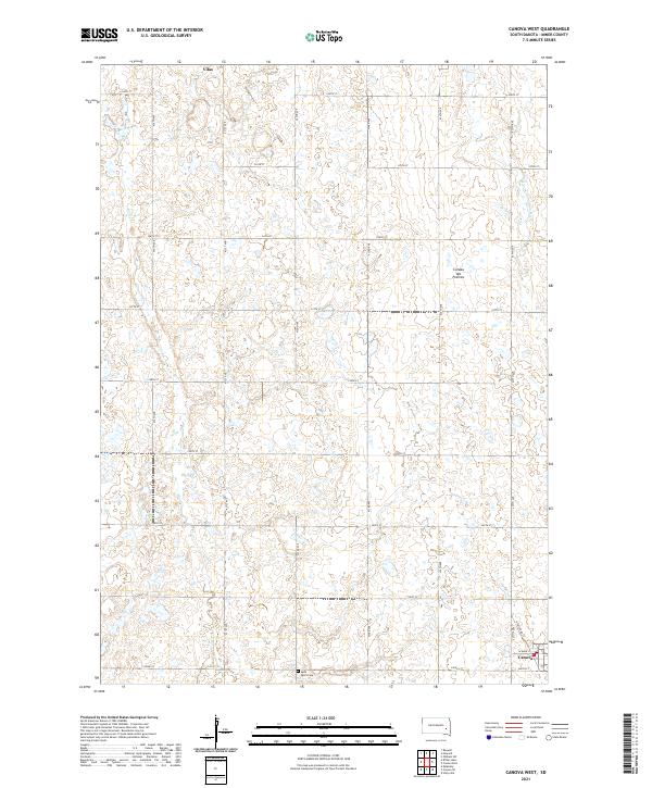
2021 Map of Canova West
USGS Topo · Published 2021About this map
Vilas sits at the northern edge of this agricultural landscape in Miner County, while the northern outskirts of Canova appear in the southeast corner. The terrain is part of the Coteau des Prairies, a high plateau characterized by numerous small depressions and wetlands scattered across the prairie. Waterways like Wolf Cr and the W Fork Vermillion River drain these uplands, carving gentle paths through the section-line grid. Local heritage is rooted in the rural road network, which connects scattered farmsteads to landmarks like Saint Paul's Cem. The map's detail within Canova includes established routes such as W Main St and South St, illustrating the town's orientation toward the surrounding fields during the early 21st century.
Find a feature on this map
27 named features on this map. Tap any name to fly to it.
Don’t see what you’re looking for? This feature index may not catch every label — zoom into the map to look around manually.
Map Details
Editions of this 2021 Canova West Map
This is the sole edition of this map. No revisions or reprints were ever made.
Other maps of this area

1899 · Alexandria
USGS Topo · 1:125,000

1899 · De Smet
USGS Topo · 1:125,000

1953 · Watertown
USGS Topo · 1:250,000

1955 · Sioux Falls
USGS Topo · 1:250,000

1958 · Sioux Falls
USGS Topo · 1:250,000

1958 · Watertown
USGS Topo · 1:250,000

1968 · Oldham SW
USGS Topo · 1:24,000

1971 · Howard
USGS Topo · 1:24,000
1971 · Canova East
USGS Topo · 1:24,000

1971 · Unityville
USGS Topo · 1:24,000