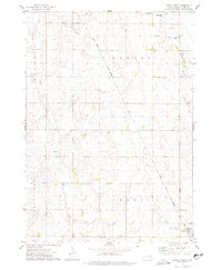
1973 Map of Canova West
USGS Topo · Published 1978About this map
Vilas and Canova stand at the corners of this prairie landscape, where the agricultural grid is interrupted only by the meandering paths of Wolf Creek and Rock Creek. This mid-1970s survey illustrates a region shaped by the Chicago and North Western railroad, which cuts a diagonal line across the townships of Howard, Roswell, and Canova. The rural infrastructure is clearly defined, showing the distribution of small-scale industry through scattered Gravel Pits and the essential community landmarks of St Pauls Cem and Graceland Cem. The drainage patterns of the West Fork Vermillion River provide a natural contrast to the rigid property and section lines, offering insight into the late 20th-century hydrology and land use of eastern Miner County.
Find a feature on this map
17 named features on this map. Tap any name to fly to it.
Don’t see what you’re looking for? This feature index may not catch every label — zoom into the map to look around manually.
Map Details
Editions of this 1973 Canova West Map
This is the sole edition of this map. No revisions or reprints were ever made.
Other maps of this area

1899 · Alexandria
USGS Topo · 1:125,000

1899 · De Smet
USGS Topo · 1:125,000

1953 · Watertown
USGS Topo · 1:250,000

1955 · Sioux Falls
USGS Topo · 1:250,000

1958 · Sioux Falls
USGS Topo · 1:250,000

1958 · Watertown
USGS Topo · 1:250,000

1968 · Oldham SW
USGS Topo · 1:24,000

1971 · Howard
USGS Topo · 1:24,000
1971 · Canova East
USGS Topo · 1:24,000

1971 · Unityville
USGS Topo · 1:24,000