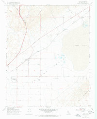
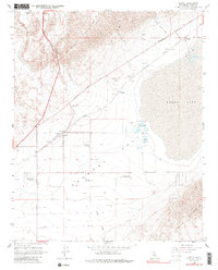
1967 Map of Cantil
USGS Topo · Published 1968About this map
The arid basin of Fremont Valley dominates this landscape, where the seasonal waters of Koehn Lake and its associated salt evaporators define the local industry near Saltdale. This 1967 survey captures the sparse desert settlements and infrastructure that supported early 20th-century mining and transport, including the Southern Pacific railroad line connecting Cantil and Gypsite. To the north, the terrain rises into the El Paso Mountains and the distinctive geological features of Red Rock Canyon.
Find a feature on this map
27 named features on this map. Tap any name to fly to it.
Don’t see what you’re looking for? This feature index may not catch every label — zoom into the map to look around manually.
Map Details
Editions of this 1967 Cantil Map
5 editions found
Other maps of this area

1915 · Searles Lake
USGS Topo · 1:250,000

1915 · Mojave
USGS Topo · 1:125,000

1943 · Cross Mountain
USGS Topo · 1:62,500

1943 · Saltdale
USGS Topo · 1:62,500

1943 · Castle Butte
USGS Topo · 1:62,500

1943 · Mojave
USGS Topo · 1:62,500

1947 · Castle Butte
USGS Topo · 1:50,000

1947 · Trona
USGS Topo · 1:250,000

1948 · Trona
USGS Topo · 1:250,000

1948 · Bakersfield
USGS Topo · 1:250,000