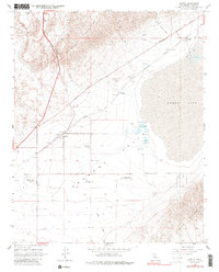
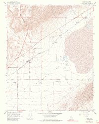
1967 Map of Cantil
USGS Topo · Published 1987About this map
Koehn Lake dominates this high-desert landscape, serving as the focal point for the industrial and rail operations that defined the region in the late 1960s. The presence of Salt Evaporators and several named wells near Saltdale illustrates the localized extraction industry, while the Southern Pacific tracks provide a vital corridor through the Fremont Valley. These rails connect small outposts like Cantil and Ceneda, traces of a desert economy built around mineral recovery and transportation.
Find a feature on this map
23 named features on this map. Tap any name to fly to it.
Don’t see what you’re looking for? This feature index may not catch every label — zoom into the map to look around manually.
Map Details
Editions of this 1967 Cantil Map
5 editions found
Other maps of this area

1915 · Searles Lake
USGS Topo · 1:250,000

1915 · Mojave
USGS Topo · 1:125,000

1943 · Cross Mountain
USGS Topo · 1:62,500

1943 · Saltdale
USGS Topo · 1:62,500

1943 · Castle Butte
USGS Topo · 1:62,500

1943 · Mojave
USGS Topo · 1:62,500

1947 · Castle Butte
USGS Topo · 1:50,000

1947 · Trona
USGS Topo · 1:250,000

1948 · Trona
USGS Topo · 1:250,000

1948 · Bakersfield
USGS Topo · 1:250,000