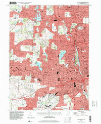
1994 Map of Canton West
USGS Topo · Published 2000About this map
Canton and North Canton dominate this mid-1990s landscape, reflecting decades of suburban expansion and urban density. The map illustrates a dense network of neighborhoods including Edgefield, Avondale, and Reedurban, alongside established industrial and institutional landmarks. Higher education and local history are well-represented by the Kent State University campus, Malone College, and the Historical Society near McKinley Memorial Park. The region's topography is punctuated by significant water features such as Meyers Lake and Lake Cable, which served as anchors for residential development. To the west, the Massillon corporate boundary meets the growing outskirts of Perry Heights and Genoa. Extensive cemetery grounds like Calvary Cemetery and Forest Hill Cemetery provide genealogical landmarks, while the Wheeling And Lake Erie and Conrail rail lines track the enduring industrial corridors that shaped the Stark County economy.
Find a feature on this map
73 named features on this map. Tap any name to fly to it.
Don’t see what you’re looking for? This feature index may not catch every label — zoom into the map to look around manually.
Map Details
Editions of this 1994 Canton West Map
This is the sole edition of this map. No revisions or reprints were ever made.
Other maps of this area

1901 · Massillon
USGS Topo · 1:62,500

1901 · Canton
USGS Topo · 1:62,500

1903 · Massillon
USGS Topo · 1:62,500

1903 · Canton
USGS Topo · 1:62,500

1912 · Dover
USGS Topo · 1:62,500

1914 · Navarre
USGS Topo · 1:62,500

1944 · Navarre
USGS Topo · 1:62,500

1944 · Dover
USGS Topo · 1:62,500

1951 · Canton
USGS Topo · 1:250,000

1951 · Bolivar
USGS Topo · 1:24,000