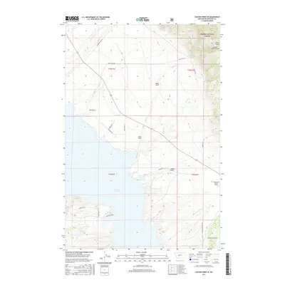
2017 Map of Canyon Ferry SE
USGS Topo · Published 2017About this map
Canyon Ferry Lake dominates the western shoreline of this 2017 landscape, where the waters of the Missouri River system meet the rising elevations of the Helena National Forest. The geography here is defined by deep drainages such as White Gulch and Confederate Gulch, names that hint at the region's mid-19th-century mining heritage and the prospectors who once worked these mountainsides. Settlement patterns are sparse, characterized by sprawling ranch land and isolated aviation facilities like the Elk Meadows Ranch Airport.
Find a feature on this map
26 named features on this map. Tap any name to fly to it.
Don’t see what you’re looking for? This feature index may not catch every label — zoom into the map to look around manually.
Map Details
Editions of this 2017 Canyon Ferry SE Map
This is the sole edition of this map. No revisions or reprints were ever made.
Other maps of this area

1886 · Fort Logan
USGS Topo · 1:250,000

1948 · White Sulphur Springs
USGS Topo · 1:250,000

1950 · Canyon Ferry
USGS Topo · 1:62,500

1950 · Townsend
USGS Topo · 1:62,500

1950 · Duck Creek Pass
USGS Topo · 1:62,500

1958 · White Sulphur Springs
USGS Topo · 1:250,000

1961 · White Sulphur Springs
USGS Topo · 1:250,000

1965 · White Sulphur Springs
USGS Topo · 1:250,000

1966 · Diamond City
USGS Topo · 1:24,000

1966 · Whites City
USGS Topo · 1:24,000