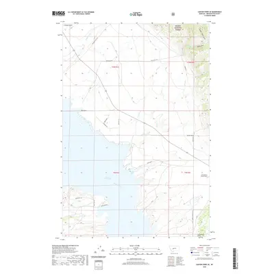
2020 Map of Canyon Ferry SE
USGS Topo · Published 2020About this map
Canyon Ferry Lake and the Missouri River dominate this modern topographic view of Broadwater County, where the high desert meets the wooded slopes of the Helena National Forest. The landscape is defined by deep, north-south running ravines such as Hellgate Gulch, White Gulch, and the locally significant Confederate Gulch. These drainages serve as natural conduits for both water and access, with historic routes like the Overland Trl and Avalanche Gulch Rd tracing the contours of the land. In the southeast, the Elk Meadows Ranch Airport indicates modern land use adjacent to the rugged terrain. The map captures the complex interaction of high-altitude forest boundaries and the expansive reservoir, reflecting the region's importance for both resource management and recreational access.
Find a feature on this map
29 named features on this map. Tap any name to fly to it.
Don’t see what you’re looking for? This feature index may not catch every label — zoom into the map to look around manually.
Map Details
Editions of this 2020 Canyon Ferry SE Map
This is the sole edition of this map. No revisions or reprints were ever made.
Other maps of this area

1886 · Fort Logan
USGS Topo · 1:250,000

1948 · White Sulphur Springs
USGS Topo · 1:250,000

1950 · Canyon Ferry
USGS Topo · 1:62,500

1950 · Townsend
USGS Topo · 1:62,500

1950 · Duck Creek Pass
USGS Topo · 1:62,500

1958 · White Sulphur Springs
USGS Topo · 1:250,000

1961 · White Sulphur Springs
USGS Topo · 1:250,000

1965 · White Sulphur Springs
USGS Topo · 1:250,000

1966 · Diamond City
USGS Topo · 1:24,000

1966 · Whites City
USGS Topo · 1:24,000