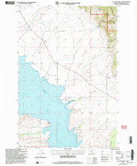
2001 Map of Canyon Ferry SE
USGS Topo · Published 2004About this map
Canyon Ferry Lake dominates this landscape on the Missouri River corridor, reflecting the reservoir's character at the dawn of the 21st century. The map highlights a developed recreational and residential interface at Goose Bay, featuring a Landing Strip, Marina, Dock, and a Mobile Home Park. This settlement pattern illustrates the shift from a river-based valley to a modern reservoir-based economy, where lakefront access became a primary driver of local land use.
Find a feature on this map
21 named features on this map. Tap any name to fly to it.
Don’t see what you’re looking for? This feature index may not catch every label — zoom into the map to look around manually.
Map Details
Editions of this 2001 Canyon Ferry SE Map
This is the sole edition of this map. No revisions or reprints were ever made.
Other maps of this area

1886 · Fort Logan
USGS Topo · 1:250,000

1948 · White Sulphur Springs
USGS Topo · 1:250,000

1950 · Canyon Ferry
USGS Topo · 1:62,500

1950 · Townsend
USGS Topo · 1:62,500

1950 · Duck Creek Pass
USGS Topo · 1:62,500

1958 · White Sulphur Springs
USGS Topo · 1:250,000

1961 · White Sulphur Springs
USGS Topo · 1:250,000

1965 · White Sulphur Springs
USGS Topo · 1:250,000

1966 · Diamond City
USGS Topo · 1:24,000

1966 · Whites City
USGS Topo · 1:24,000