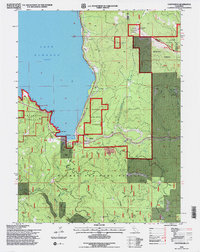
1994 Map of Canyondam
USGS Topo · Published 1997About this map
Lake Almanor and the rugged mountainous border between Plumas and Lassen Counties define this 1990s landscape. High-altitude landmarks like the Dyer Mtn Lookout at over 7,000 feet overlook a region dominated by timber and mineral extraction within the Lassen National Forest and Plumas National Forest. The Union Pacific railroad line follows the western shoreline and cuts through the terrain with a series of Tunnels south of Canyondam.
Find a feature on this map
46 named features on this map. Tap any name to fly to it.
Don’t see what you’re looking for? This feature index may not catch every label — zoom into the map to look around manually.
Map Details
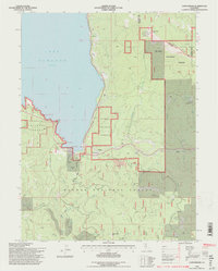
Editions of this 1994 Canyondam Map
2 editions found
Other maps of this area

1886 · Honey Lake
USGS Topo · 1:250,000

1886 · Lassen Peak
USGS Topo · 1:250,000

1891 · Honey Lake
USGS Topo · 1:250,000

1892 · Lassen Peak
USGS Topo · 1:250,000

1893 · Honey Lake
USGS Topo · 1:250,000

1894 · Lassen Peak
USGS Topo · 1:250,000

1950 · Greenville
USGS Topo · 1:62,500

1955 · Westwood
USGS Topo · 1:62,500

1955 · Almanor
USGS Topo · 1:62,500

1955 · Westwood
USGS Topo · 1:250,000