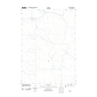
2012 Map of Capa
USGS Topo · Published 2012About this map
The small settlement of Capa sits along the northern reaches of this Jones County landscape, positioned near the meandering course of the Bad River. This 2012 survey illustrates a sparsely populated region of South Dakota where the topography is defined by significant landmarks like Flat Top Butte and a network of drainages including South Creek, Big Prairie Dog Creek, and Dry Creek. Local history is anchored at the Riverview Cemetery south of the primary townsite, providing a point of interest for genealogists tracing families in this prairie environment. The road network is dominated by rural routes such as Bad River Road, which follow the natural contours of the river valley, connecting the isolated homesteads and ranch lands that characterize the area.
Find a feature on this map
10 named features on this map. Tap any name to fly to it.
Don’t see what you’re looking for? This feature index may not catch every label — zoom into the map to look around manually.
Map Details
Editions of this 2012 Capa Map
This is the sole edition of this map. No revisions or reprints were ever made.
Other maps of this area

1951 · Capa
USGS Topo · 1:24,000

1951 · Van Metre
USGS Topo · 1:24,000

1951 · Capa NW
USGS Topo · 1:24,000

1951 · Capa SE
USGS Topo · 1:24,000

1954 · Midland SE
USGS Topo · 1:24,000

1954 · Pierre
USGS Topo · 1:250,000

1955 · Martin
USGS Topo · 1:250,000

1958 · Pierre
USGS Topo · 1:250,000

1958 · Martin
USGS Topo · 1:250,000

1972 · Okaton
USGS Topo · 1:24,000