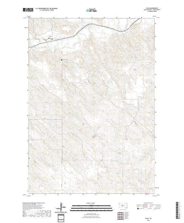
2021 Map of Capa
USGS Topo · Published 2021About this map
Capa is the primary settlement on this South Dakota landscape, situated along the northern banks of the Bad River. The terrain is defined by the winding course of the river and its tributaries, including Big Prairie Dog Cr and Dry Cr. Local road networks like O'Conner Loop and 258th Ave provide access to the rural surroundings and isolated points of interest. Genealogists and local historians will find significant detail in the inclusion of Saint Mark's Cem and Riverview Cem, which serve as quiet landmarks in this sparsely populated region. To the south, the prominent elevation of Flat Top Butte rises above the prairie, offering a clear geographic marker for the area's topography. The map illustrates a ranching and rural residential pattern typical of central Jones County, where land use is dictated by the availability of water and the rise of the buttes.
Find a feature on this map
16 named features on this map. Tap any name to fly to it.
Don’t see what you’re looking for? This feature index may not catch every label — zoom into the map to look around manually.
Map Details
Editions of this 2021 Capa Map
This is the sole edition of this map. No revisions or reprints were ever made.
Other maps of this area

1951 · Capa
USGS Topo · 1:24,000

1951 · Van Metre
USGS Topo · 1:24,000

1951 · Capa NW
USGS Topo · 1:24,000

1951 · Capa SE
USGS Topo · 1:24,000

1954 · Midland SE
USGS Topo · 1:24,000

1954 · Pierre
USGS Topo · 1:250,000

1955 · Martin
USGS Topo · 1:250,000

1958 · Pierre
USGS Topo · 1:250,000

1958 · Martin
USGS Topo · 1:250,000

1972 · Okaton
USGS Topo · 1:24,000