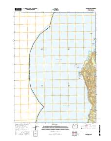
2017 Map of Cape Arago
USGS Topo · Published 2017About this map
Cape Arago and the jagged promontories of the Coos County coastline dominate this 2017 study, where the Pacific shelf meets the forested bluffs of the Seven Devils range. The geography here is defined by maritime hazards and protective coves, from the exposed Baltimore Rock and Simpson Reef to the sheltered waters of Sunset Bay. Inland, the terrain is deeply incised by drainages like Big Devil Gulch and Norton Gulch, which feed into the sea alongside several small coastal streams including Mussel Cr and Threemile Cr.
Find a feature on this map
28 named features on this map. Tap any name to fly to it.
Don’t see what you’re looking for? This feature index may not catch every label — zoom into the map to look around manually.
Map Details
Editions of this 2017 Cape Arago Map
This is the sole edition of this map. No revisions or reprints were ever made.
Other maps of this area

1896 · Coos Bay
USGS Topo · 1:125,000

1898 · Coos Bay
USGS Topo · 1:125,000

1900 · Coos Bay
USGS Topo · 1:125,000

1942 · Empire
USGS Topo · 1:62,500

1943 · Bandon
USGS Topo · 1:62,500

1944 · Empire
USGS Topo · 1:62,500

1944 · Bandon
USGS Topo · 1:62,500

1954 · Coos Bay
USGS Topo · 1:250,000

1958 · Coos Bay
USGS Topo · 1:250,000

1962 · Coos Bay
USGS Topo · 1:250,000