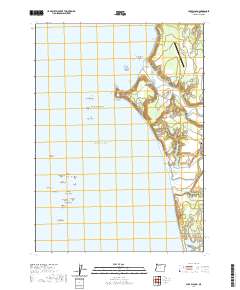
2020 Map of Cape Blanco
USGS Topo · Published 2020About this map
Cape Blanco projects sharply into the Pacific Ocean, anchoring a landscape where the Sixes River and Elk River meet the coast. This contemporary survey reveals the intricate maritime hazards of Blanco Reef and Orford Reef, featuring distinctively named formations like Steamboat Rock, Arch Rock, and Pyramid Rock. The coastal interface is defined by significant landmarks including the Cape Blanco State Airport and the historic Hughes Family Cem located near the river mouth. Further south, the map details the northern reaches of Port Orford, where Garrison Lake is separated from the sea by a narrow stretch of land. The terrain includes notable elevations like Squaw Bluff and coastal features such as Tituna Spit, illustrating the complex intersection of river drainage and tidal influence in Curry County.
Find a feature on this map
48 named features on this map. Tap any name to fly to it.
Don’t see what you’re looking for? This feature index may not catch every label — zoom into the map to look around manually.
Map Details
Editions of this 2020 Cape Blanco Map
This is the sole edition of this map. No revisions or reprints were ever made.
Other maps of this area

1899 · Port Orford
USGS Topo · 1:125,000

1903 · Port Orford
USGS Topo · 1:125,000

1954 · Coos Bay
USGS Topo · 1:250,000

1954 · Port Orford
USGS Topo · 1:62,500

1954 · Cape Blanco
USGS Topo · 1:62,500

1954 · Langlois
USGS Topo · 1:62,500

1958 · Coos Bay
USGS Topo · 1:250,000

1962 · Coos Bay
USGS Topo · 1:250,000
1986 · Langlois
USGS Topo · 1:24,000
1986 · Floras Lake
USGS Topo · 1:24,000