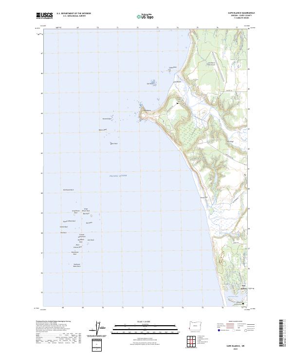
2023 Map of Cape Blanco
USGS Topo · Published 2023About this map
Cape Blanco stands as the westernmost point of the contiguous United States on this 2023 survey of the Oregon coast. The landscape is defined by the sharp transition from the Pacific Ocean to the high elevations of Sixes Bluff, with the Sixes River and Elk River cutting through the coastal plain toward the sea. The map documents the extensive Oregon Islands National Wildlife Refuge, which encompasses numerous offshore features such as Blanco Reef, Orford Reef, and Castle Rock. Inland, the settlement of Port Orford sits at the southern edge, bordered by Garrison Lake and Buffington Memorial Park. Genealogists may find interest in the Hughes Family Cem located near the river mouth, while the presence of the Cape Blanco State Airport and roads like Knapp Rd and Silver Butte Rd show the modern infrastructure supporting this remote maritime region.
Find a feature on this map
47 named features on this map. Tap any name to fly to it.
Don’t see what you’re looking for? This feature index may not catch every label — zoom into the map to look around manually.
Map Details
Editions of this 2023 Cape Blanco Map
This is the sole edition of this map. No revisions or reprints were ever made.
Other maps of this area

1899 · Port Orford
USGS Topo · 1:125,000

1903 · Port Orford
USGS Topo · 1:125,000

1954 · Coos Bay
USGS Topo · 1:250,000

1954 · Port Orford
USGS Topo · 1:62,500

1954 · Cape Blanco
USGS Topo · 1:62,500

1954 · Langlois
USGS Topo · 1:62,500

1958 · Coos Bay
USGS Topo · 1:250,000

1962 · Coos Bay
USGS Topo · 1:250,000
1986 · Langlois
USGS Topo · 1:24,000
1986 · Floras Lake
USGS Topo · 1:24,000