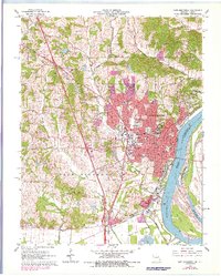
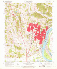
1967 Map of Cape Girardeau
USGS Topo · Published 1978About this map
The Mississippi River dominates the eastern edge of this late-1960s survey, framing the city of Cape Girardeau and its shifting islands like Marquette Island and Giboney Island. The urban landscape is marked by a concentration of religious and educational institutions, including St Vincents College, Notre Dame High Sch, and Trinity Sch. Industrial development is evident near the riverfront with a large Cement Plant and Sewage Disposal facilities, while the western periphery maintains a mix of public spaces like Klaus Park and smaller residential pockets like Marietta.
Find a feature on this map
71 named features on this map. Tap any name to fly to it.
Don’t see what you’re looking for? This feature index may not catch every label — zoom into the map to look around manually.
Map Details
Editions of this 1967 Cape Girardeau Map
2 editions found
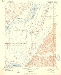
Other maps of this area

1920 · Jonesboro
USGS Topo · 1:62,500

1922 · Cape Girardeau
USGS Topo · 1:62,500

1923 · Jonesboro
USGS Topo · 1:62,500

1924 · Cape Girardeau
USGS Topo · 1:62,500

1934 · Thebes
USGS Topo · 1:62,500

1934 · Morley
USGS Topo · 1:62,500

1939 · Morley
USGS Topo · 1:62,500

1939 · Thebes
USGS Topo · 1:62,500

1947 · Jonesboro
USGS Topo · 1:62,500
1947 · Mc Clure
USGS Topo · 1:24,000