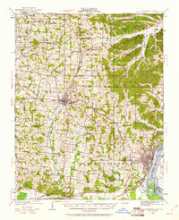
1922 Map of Cape Girardeau
USGS Topo · Published 1961About this map
Cape Girardeau and the surrounding river bottoms define the southeast corner of this early 1920s landscape, where the Mississippi River creates a natural boundary with Illinois. The regional topography is characterized by a dense network of rural one-room schoolhouses, including Schoenebeck School, Dogwood School, and Abernathy School, indicating a well-settled agricultural society before the consolidation of rural districts. Transportation is anchored by the Missouri Pacific and the St Louis San Francisco and Missouri Illinois railroads, which facilitated trade through hubs like Jackson and Pocahontas. Local history researchers can find smaller stops and landings such as Gulf Junction and Neelys Landing, along with early road networks like the Cape Girardeau and Perryville Road. The map provides a clear picture of the township divisions including Shawnee, Byrd, and Hubble, reflecting the early 20th-century political and social geography of Cape Girardeau County.
Find a feature on this map
71 named features on this map. Tap any name to fly to it.
Don’t see what you’re looking for? This feature index may not catch every label — zoom into the map to look around manually.
Map Details
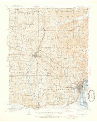
Editions of this 1922 Cape Girardeau Map
3 editions found
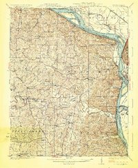
Other maps of this area

1918 · Altenburg
USGS Topo · 1:62,500

1920 · Jonesboro
USGS Topo · 1:62,500

1922 · Cape Girardeau
USGS Topo · 1:62,500

1923 · Jonesboro
USGS Topo · 1:62,500

1923 · Perryville
USGS Topo · 1:62,500

1924 · Cape Girardeau
USGS Topo · 1:62,500

1924 · Perryville
USGS Topo · 1:62,500

1924 · Alto Pass
USGS Topo · 1:62,500
1925 · Altenburg
USGS Topo · 1:62,500

1933 · Marble Hill
USGS Topo · 1:62,500