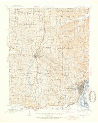
1922 Map of Cape Girardeau
USGS Topo · Published 1954About this map
Cape Girardeau anchors the southeast corner of this survey, where the Mississippi River creates a natural boundary between Missouri and Illinois. In the early 1920s, the region was defined by a dense network of rural school districts and rail infrastructure. The St Louis San Francisco railroad connects key nodes like Jackson, Pocahontas Sta, and Gulf Junction, illustrating the area's role as a transportation hub for agricultural goods.
Find a feature on this map
69 named features on this map. Tap any name to fly to it.
Don’t see what you’re looking for? This feature index may not catch every label — zoom into the map to look around manually.
Map Details
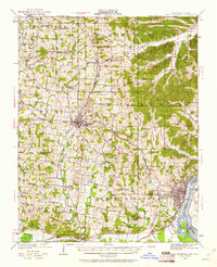
Editions of this 1922 Cape Girardeau Map
3 editions found
Other maps of this area

1918 · Altenburg
USGS Topo · 1:62,500

1920 · Jonesboro
USGS Topo · 1:62,500

1922 · Cape Girardeau
USGS Topo · 1:62,500

1923 · Jonesboro
USGS Topo · 1:62,500

1923 · Perryville
USGS Topo · 1:62,500

1924 · Cape Girardeau
USGS Topo · 1:62,500

1924 · Perryville
USGS Topo · 1:62,500

1924 · Alto Pass
USGS Topo · 1:62,500

1925 · Altenburg
USGS Topo · 1:62,500

1933 · Marble Hill
USGS Topo · 1:62,500