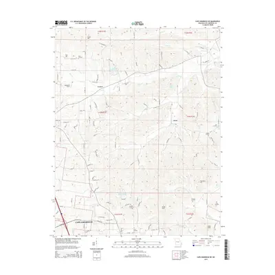
2015 Map of Cape Girardeau NE
USGS Topo · Published 2015About this map
Cape Girardeau sits at the southern edge of this landscape, where the urban grid gives way to the ridges and creek valleys of northern Cape Girardeau County. The terrain is defined by a series of prominent rises including Grassy Knob, Tricky Hill, and Coker Knob, which overlook the winding paths of Indian Cr and Little Indian Cr. The map captures a mix of established rural settlements like Leemon and Oriole alongside newer developments like the N Hills Estate Subdivision Lake. Genealogy researchers will find significant value in the numerous family and community burial grounds documented here, including the Vangilder Cemetery, Darby Cemetery, and Thompson Cemetery. The area’s aviation history is represented by the Mooseberry Airport, while the local hydrology is shaped by bodies of water such as Bella Vista Lake and Lipps Lake.
Find a feature on this map
57 named features on this map. Tap any name to fly to it.
Don’t see what you’re looking for? This feature index may not catch every label — zoom into the map to look around manually.
Map Details
Editions of this 2015 Cape Girardeau NE Map
This is the sole edition of this map. No revisions or reprints were ever made.
Other maps of this area

1918 · Altenburg
USGS Topo · 1:62,500

1920 · Jonesboro
USGS Topo · 1:62,500

1922 · Cape Girardeau
USGS Topo · 1:62,500

1923 · Jonesboro
USGS Topo · 1:62,500

1924 · Cape Girardeau
USGS Topo · 1:62,500

1924 · Alto Pass
USGS Topo · 1:62,500

1925 · Altenburg
USGS Topo · 1:62,500

1947 · Jonesboro
USGS Topo · 1:62,500

1947 · Alto Pass
USGS Topo · 1:62,500

1947 · Mc Clure
USGS Topo · 1:24,000