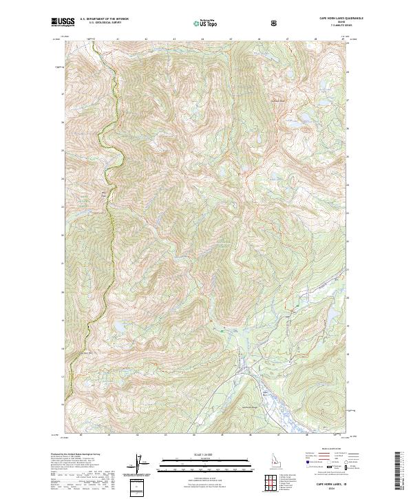
2024 Map of Cape Horn Lakes
USGS Topo · Published 2024About this map
The Middle Fork Salmon River carves through the northwestern corner of this territory, marking a boundary where the Boise National Forest meets the massive Frank Church-River of No Return Wilderness. The landscape is defined by high alpine water systems and significant peaks of the Sawtooth Range, including Cape Horn Mtn and Ruffneck Peak. A network of trails and primitive roads, such as Seafoam Rd and the Langer Lake Trl, provides access to remote high-altitude basins.
Find a feature on this map
60 named features on this map. Tap any name to fly to it.
Don’t see what you’re looking for? This feature index may not catch every label — zoom into the map to look around manually.
Map Details
Editions of this 2024 Cape Horn Lakes Map
This is the sole edition of this map. No revisions or reprints were ever made.
Other maps of this area

1891 · Bear Valley
USGS Topo · 1:125,000

1893 · Bear Valley
USGS Topo · 1:125,000

1957 · Challis
USGS Topo · 1:250,000

1960 · Challis
USGS Topo · 1:250,000

1961 · Greyhound Ridge
USGS Topo · 1:62,500

1961 · Chinook Mtn
USGS Topo · 1:62,500

1963 · Challis
USGS Topo · 1:250,000

1972 · Bull Trout Point
USGS Topo · 1:24,000
1972 · Langer Peak
USGS Topo · 1:24,000
1972 · Banner Summit
USGS Topo · 1:24,000