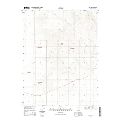
2014 Map of Cape Horn
USGS Topo · Published 2014About this map
Simpson Park Mountains dominate this high-desert landscape in Lander County, showing the intricate topography of Central Nevada. The western portion of the map transitions into the Big Smoky Valley, a broad basin defined by the dramatic relief of the adjacent mountain range. This 2014 US Topo revision identifies Cape Horn as a prominent local landmark, likely named for its distinctive sharp bend or ridge profile. Significant for those studying the regional geography, the map records Ackerman Spring tucked into a canyon on the eastern slopes, a vital water source in this arid environment. The map also delineates several Public Land Survey System township boundaries, including t19n r46e and t18n r45.5e, which provide the cadastral framework for land ownership and history in the area.
Find a feature on this map
11 named features on this map. Tap any name to fly to it.
Don’t see what you’re looking for? This feature index may not catch every label — zoom into the map to look around manually.
Map Details
Editions of this 2014 Cape Horn Map
This is the sole edition of this map. No revisions or reprints were ever made.
Other maps of this area

1926 · Roberts Mountains
USGS Topo · 1:250,000

1929 · Roberts Mountains
USGS Topo · 1:250,000

1955 · Millett
USGS Topo · 1:250,000

1956 · Mount Callaghan
USGS Topo · 1:62,500

1956 · Ackerman Canyon
USGS Topo · 1:62,500

1959 · Millett
USGS Topo · 1:250,000

1960 · Hickison Summit
USGS Topo · 1:62,500

1960 · Spencer Hot Springs
USGS Topo · 1:62,500

1978 · Summit Mountain
USGS Topo · 1:100,000

1979 · Simpson Park Mtns
USGS Topo · 1:100,000