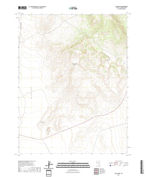
2021 Map of Cape Horn
USGS Topo · Published 2021About this map
The Simpson Park Mountains dominate this high-desert landscape in Lander County, providing a stark topographical contrast to the broad Big Smoky Valley to the west. This 2021 survey details the northern reaches of the range, centered around the distinctive promontory of Cape Horn. Of significant cultural importance is the Hickison Petroglyph Recreation Area, located in the northeastern quadrant of the map. This area contains the Hickison Petroglyph Recreation Area Trail Phase 1, which traces through a region known for its ancient rock art and prehistoric significance. Water sources are scarce in this arid environment, making the location of Ackerman Spring a critical landmark for both historical travel and modern land management. The map also delineates several township and range boundaries, including t18.5n r46e and t19n r46e, reflecting the complex public land survey system characteristic of the Great Basin.
Find a feature on this map
14 named features on this map. Tap any name to fly to it.
Don’t see what you’re looking for? This feature index may not catch every label — zoom into the map to look around manually.
Map Details
Editions of this 2021 Cape Horn Map
This is the sole edition of this map. No revisions or reprints were ever made.
Other maps of this area

1926 · Roberts Mountains
USGS Topo · 1:250,000

1929 · Roberts Mountains
USGS Topo · 1:250,000

1955 · Millett
USGS Topo · 1:250,000

1956 · Mount Callaghan
USGS Topo · 1:62,500

1956 · Ackerman Canyon
USGS Topo · 1:62,500

1959 · Millett
USGS Topo · 1:250,000

1960 · Hickison Summit
USGS Topo · 1:62,500

1960 · Spencer Hot Springs
USGS Topo · 1:62,500

1978 · Summit Mountain
USGS Topo · 1:100,000

1979 · Simpson Park Mtns
USGS Topo · 1:100,000