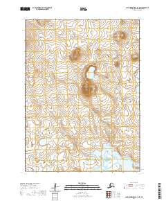
2020 Map of Cape Mendenhall D-3 NW
USGS Topo · Published 2020About this map
Nunivak Island dominates this sub-arctic terrain in the Bethel Census Area, showcasing a landscape defined by volcanic morphology and numerous small coastal lakes. This 2020 record reflects the modern topography of the island's interior, where a series of subtle rises and marshy depressions drain toward the south. Along the southern edge, the map meets the Bering Sea, highlighting the transition from the upland tundra to the maritime environment. The survey detail includes established township and range lines, such as t2s r97w and t3s r98w, which organize this largely uninhabited expanse for federal land management and environmental monitoring.
Find a feature on this map
6 named features on this map. Tap any name to fly to it.
Don’t see what you’re looking for? This feature index may not catch every label — zoom into the map to look around manually.
Map Details
Editions of this 2020 Cape Mendenhall D-3 NW Map
This is the sole edition of this map. No revisions or reprints were ever made.
Other maps of this area

1951 · Cape Mendenhall
USGS Topo · 1:250,000

1951 · Nunivak Island
USGS Topo · 1:250,000

1952 · Cape Mendenhall D-4
USGS Topo · 1:63,360

1952 · Cape Mendenhall D-3
USGS Topo · 1:63,360

1952 · Nunivak Island A-4
USGS Topo · 1:63,360

1952 · Cape Mendenhall
USGS Topo · 1:250,000

1952 · Nunivak Island A-3
USGS Topo · 1:63,360

1954 · Nunivak Island
USGS Topo · 1:250,000

1958 · Nunivak Island
USGS Topo · 1:250,000

1964 · Nunivak Island
USGS Topo · 1:250,000