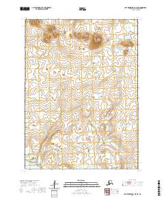
2020 Map of Cape Mendenhall D-5 NE
USGS Topo · Published 2020About this map
Nunivak Island rises from the Bering Sea in this topographic study, revealing a landscape defined by isolated elevations and coastal hydrology. The dominant landmark of the quadrangle is Binat-ingrat Hill, a distinct summit situated in the northeastern portion of the sheet. The terrain is characterized by a high concentration of small lakes and ponds, typical of the island’s subarctic tundra. Surveyed sections under t2s r101w and t3s r101w show no permanent settlements or infrastructure, emphasizing the remote nature of this island environment during the early twenty-first century. The mapping reflects the intersection of the Bering Sea shoreline with the western edges of the island, where numerous small water bodies and seasonal wetlands pocket the low-lying plains.
Find a feature on this map
7 named features on this map. Tap any name to fly to it.
Don’t see what you’re looking for? This feature index may not catch every label — zoom into the map to look around manually.
Map Details
Editions of this 2020 Cape Mendenhall D-5 NE Map
This is the sole edition of this map. No revisions or reprints were ever made.
Other maps of this area

1951 · Cape Mendenhall
USGS Topo · 1:250,000

1951 · Nunivak Island
USGS Topo · 1:250,000

1952 · Cape Mendenhall D-4
USGS Topo · 1:63,360

1952 · Nunivak Island A-4
USGS Topo · 1:63,360

1952 · Cape Mendenhall
USGS Topo · 1:250,000

1952 · Nunivak Island A-5
USGS Topo · 1:63,360
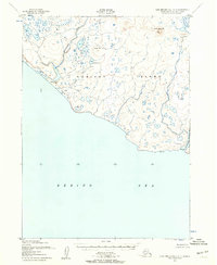
1952 · Cape Mendenhall D-5
USGS Topo · 1:63,360

1954 · Nunivak Island
USGS Topo · 1:250,000

1958 · Nunivak Island
USGS Topo · 1:250,000

1964 · Nunivak Island
USGS Topo · 1:250,000