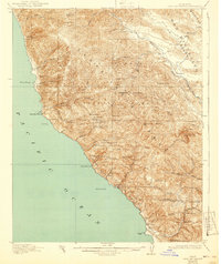
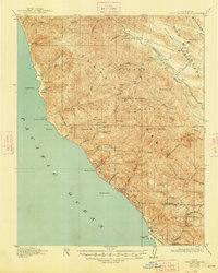
1921 Map of Cape San Martin
USGS Topo · Published 1940About this map
The Santa Lucia Range dominates this coastal survey, where the steep terrain of the Los Padres National Forest meets the Pacific Ocean. Early 20th-century life here was defined by isolated ranching and mining operations tucked into deep coastal canyons. The map documents several active and inactive workings, including the Gorda Mine, Melville Mine, and the Calizona Mines (abandoned).
Find a feature on this map
63 named features on this map. Tap any name to fly to it.
Don’t see what you’re looking for? This feature index may not catch every label — zoom into the map to look around manually.
Map Details
Editions of this 1921 Cape San Martin Map
6 editions found
Other maps of this area

1919 · King City
USGS Topo · 1:62,500

1919 · Junipero Serra
USGS Topo · 1:62,500

1919 · Bryson
USGS Topo · 1:62,500

1919 · Piedras Blancas
USGS Topo · 1:62,500

1919 · San Simeon
USGS Topo · 1:62,500

1921 · Cape San Martin
USGS Topo · 1:62,500

1921 · Lucia
USGS Topo · 1:62,500

1927 · Piedras Blancas
USGS Topo · 1:62,500

1937 · San Simeon
USGS Topo · 1:62,500

1939 · King City
USGS Topo · 1:62,500