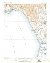
1912 Map of Capitola
USGS Topo · Published 1960About this map
Southern Pacific rail lines define the early twentieth-century coastal development of the Monterey Bay shoreline, connecting the resort atmosphere of Capitola and Twin Lakes to the agricultural hub of Watsonville. The landscape is a transition from the wooded elevations of Soquel Augmentation down through the alluvial plains of Corralitos and Aptos to the salt marshes of the south.
Find a feature on this map
67 named features on this map. Tap any name to fly to it.
Don’t see what you’re looking for? This feature index may not catch every label — zoom into the map to look around manually.
Map Details
Editions of this 1912 Capitola Map
2 editions found
Other maps of this area

1902 · Santa Cruz
USGS Topo · 1:125,000

1910 · Salinas
USGS Topo · 1:31,680

1912 · Salinas
USGS Topo · 1:62,500

1912 · Capitola
USGS Topo · 1:62,500

1913 · Monterey
USGS Topo · 1:62,500

1914 · Capitola
USGS Topo · 1:62,500

1915 · San Juan Bautista
USGS Topo · 1:48,000

1916 · New Almaden
USGS Topo · 1:48,000

1917 · Morgan Hill
USGS Topo · 1:62,500

1917 · San Juan Bautista
USGS Topo · 1:62,500