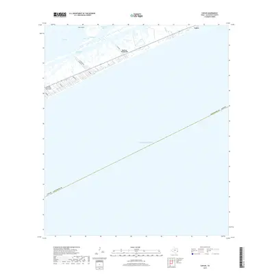
2019 Map of Caplen
USGS Topo · Published 2019About this map
Bolivar Peninsula stretches across this coastal survey, forming a narrow barrier between the Gulf of Mexico and the expansive waters of East Bay. The settlement of Caplen sits along the northeastern edge of the peninsula, where the land is scored by local access roads such as N Tuna Dr and N Stingaree Dr. The geography is defined by a complex network of wetlands and tidal channels, including Yates Bayou and Big Pasture Bayou, which drain into Yates Cove.
Find a feature on this map
21 named features on this map. Tap any name to fly to it.
Don’t see what you’re looking for? This feature index may not catch every label — zoom into the map to look around manually.
Map Details
Editions of this 2019 Caplen Map
This is the sole edition of this map. No revisions or reprints were ever made.
Other maps of this area

1931 · Flake
USGS Topo · 1:24,000

1931 · High Island
USGS Topo · 1:24,000

1931 · Frozen Point
USGS Topo · 1:24,000

1933 · Frozen Point
USGS Topo · 1:31,680

1933 · Caplen
USGS Topo · 1:31,680

1933 · The Jetties
USGS Topo · 1:31,680

1933 · Whites Lake
USGS Topo · 1:31,680

1933 · Flake
USGS Topo · 1:31,680

1943 · High Island
USGS Topo · 1:31,680
1943 · Flake
USGS Topo · 1:25,000