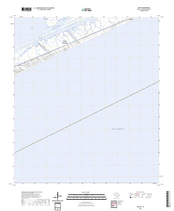
2025 Map of Caplen
USGS Topo · Published 2025About this map
The Bolivar Peninsula acts as a narrow coastal barrier between the Gulf of America and the protected waters of East Bay. This 2025 survey illustrates the modern configuration of the coastal settlement of Caplen, where residential streets like N Redfish St and Treasure Ln sit just inland from the Gulf shoreline. The landscape is defined by the vital transit corridor of the Intracoastal Waterway, which separates the main peninsula from the marshy islands and inlets to the north. Smaller water features such as Yates Bayou and Big Pasture Bayou weave through the low-lying terrain near Goat Island, highlighting the complex hydrology of the Texas coast. Local aviation is represented by the Seafood Warehouse Park Airport, reflecting the specialized coastal economy and infrastructure of Galveston County.
Find a feature on this map
21 named features on this map. Tap any name to fly to it.
Don’t see what you’re looking for? This feature index may not catch every label — zoom into the map to look around manually.
Map Details
Editions of this 2025 Caplen Map
This is the sole edition of this map. No revisions or reprints were ever made.
Other maps of this area

1931 · Flake
USGS Topo · 1:24,000

1931 · High Island
USGS Topo · 1:24,000

1931 · Frozen Point
USGS Topo · 1:24,000

1933 · Frozen Point
USGS Topo · 1:31,680

1933 · Caplen
USGS Topo · 1:31,680

1933 · The Jetties
USGS Topo · 1:31,680

1933 · Whites Lake
USGS Topo · 1:31,680

1933 · Flake
USGS Topo · 1:31,680

1943 · High Island
USGS Topo · 1:31,680
1943 · Flake
USGS Topo · 1:25,000