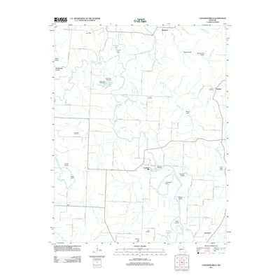
2011 Map of Caplinger Mills
USGS Topo · Published 2011About this map
Caplinger Mills serves as the focal point of this region, situated where the Sac River is harnessed by the Caplinger Mills Dam. The surrounding landscape is defined by the winding river corridor and its numerous tributaries, including Turkey Creek and Cedar Creek. The settlement pattern is characterized by small crossroads communities and family-named landmarks that reflect the area's deep-rooted history. Genealogists will find several burial grounds across the township, such as Hackleman Cemetery, Rookins Cemetery, and Preston Cemetery. The terrain is marked by distinctive features like Masters Island and Keith Island, while the eastern reaches are punctuated by the Coal Bank Hills and numerous hollows like Panther Den Hollow, indicating a history of varied land use and local navigation along the river's bends.
Find a feature on this map
96 named features on this map. Tap any name to fly to it.
Don’t see what you’re looking for? This feature index may not catch every label — zoom into the map to look around manually.
Map Details
Editions of this 2011 Caplinger Mills Map
This is the sole edition of this map. No revisions or reprints were ever made.
Other maps of this area

1886 · Stockton
USGS Topo · 1:125,000

1937 · Tiffin
USGS Topo · 1:31,680

1938 · Roscoe
USGS Topo · 1:24,000

1938 · Vista
USGS Topo · 1:24,000

1939 · Caplinger Mills
USGS Topo · 1:24,000

1939 · Arnica
USGS Topo · 1:24,000

1939 · Filley
USGS Topo · 1:24,000

1940 · Roscoe
USGS Topo · 1:24,000

1940 · Filley
USGS Topo · 1:24,000

1940 · Vista
USGS Topo · 1:24,000