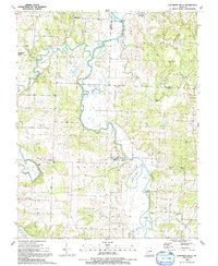
1991 Map of Caplinger Mills
USGS Topo · Published 1991About this map
Caplinger Mills serves as a central landmark in this 1991 survey, situated where the Sac River winds through Cedar County. The landscape is defined by the river's serpentine path, creating dramatic landforms like Horseshoe Bend and providing a foundation for local recreation at the Campground and Boat Ramp. The map captures a rural Missouri landscape marked by traditional family-named features and small community nodes such as Leila Store and Hackleman Corner.
Find a feature on this map
47 named features on this map. Tap any name to fly to it.
Don’t see what you’re looking for? This feature index may not catch every label — zoom into the map to look around manually.
Map Details
Editions of this 1991 Caplinger Mills Map
This is the sole edition of this map. No revisions or reprints were ever made.
Other maps of this area

1886 · Stockton
USGS Topo · 1:125,000

1937 · Tiffin
USGS Topo · 1:31,680

1938 · Roscoe
USGS Topo · 1:24,000

1938 · Vista
USGS Topo · 1:24,000

1939 · Caplinger Mills
USGS Topo · 1:24,000

1939 · Arnica
USGS Topo · 1:24,000

1939 · Filley
USGS Topo · 1:24,000

1940 · Roscoe
USGS Topo · 1:24,000

1940 · Filley
USGS Topo · 1:24,000

1940 · Vista
USGS Topo · 1:24,000