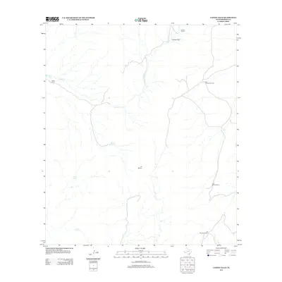
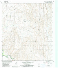
2012 Map of Capote Falls
USGS Topo · Published 2012About this map
Capote Cr defines the drainage of this arid Presidio County landscape, winding toward the landmark Capote Falls in the northern reaches. The settlement pattern is sparse, centered on the Capote Ranch and the locality of El Macho. Water management is the primary human imprint on the land, evidenced by a network of isolated springs and livestock infrastructure. Vital water sources like Mexican Spring, Adobe Spring, and Nixon Spring are scattered across the terrain, supporting the ranching operations that have long characterized this part of the Trans-Pecos. The map reveals the critical importance of groundwater in this environment, where named windmills serve as essential hubs for the survival of both people and livestock in the Cienega Basin.
Find a feature on this map
13 named features on this map. Tap any name to fly to it.
Don’t see what you’re looking for? This feature index may not catch every label — zoom into the map to look around manually.
Map Details
Editions of this 2012 Capote Falls Map
This is the sole edition of this map. No revisions or reprints were ever made.
Other maps of this area

1895 · Marfa
USGS Topo · 1:125,000

1896 · San Carlos
USGS Topo · 1:125,000

1959 · Marfa
USGS Topo · 1:250,000

1965 · Marfa
USGS Topo · 1:250,000
1978 · Capote Peak
USGS Topo · 1:24,000

1979 · Ruidosa Hot Springs
USGS Topo · 1:24,000

1979 · Capote Falls
USGS Topo · 1:24,000
1979 · Candelaria
USGS Topo · 1:24,000
1979 · Pueblo Nuevo
USGS Topo · 1:24,000
1979 · McComb Canyon
USGS Topo · 1:24,000