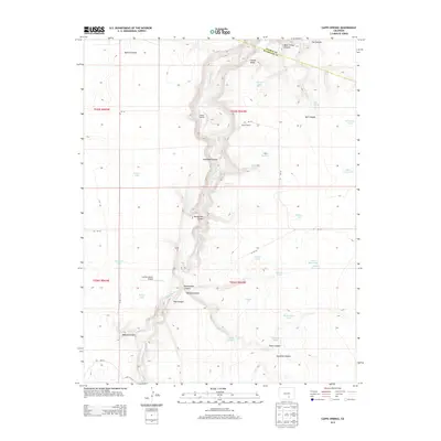
2013 Map of Capps Springs
USGS Topo · Published 2013About this map
The Cucharas River carves a deep path through this Colorado landscape, where the Pueblo Co and Huerfano Co boundary line meets. This 2013 survey illustrates a semi-arid terrain defined by an extensive network of drainage features, including Keystone Canyon, Emma Paul Canyon, and Rattlesnake Canyon. Human activity is concentrated around scattered ranching and resource extraction sites, such as Kenner Ranch and the Collins Pit. Water management is central to the area's utility, marked by numerous man-made and natural catchments like Wyatt Reservoir, Salyers Reservoir, and the namesake Capps Springs. The presence of the Cuchara Ranch Airport in the western portion of the map suggests the logistical importance of private aviation in this high-altitude cattle and ranching country.
Find a feature on this map
46 named features on this map. Tap any name to fly to it.
Don’t see what you’re looking for? This feature index may not catch every label — zoom into the map to look around manually.
Map Details
Editions of this 2013 Capps Springs Map
This is the sole edition of this map. No revisions or reprints were ever made.
Other maps of this area

1891 · Walsenburg
USGS Topo · 1:125,000

1891 · Apishapa
USGS Topo · 1:125,000

1893 · Apishapa
USGS Topo · 1:125,000

1894 · Walsenburg
USGS Topo · 1:125,000

1897 · Walsenburg
USGS Topo · 1:125,000

1897 · Apishapa
USGS Topo · 1:125,000

1900 · Walsenburg
USGS Topo · 1:125,000

1954 · Trinidad
USGS Topo · 1:250,000

1955 · Trinidad
USGS Topo · 1:250,000

1958 · Trinidad
USGS Topo · 1:250,000