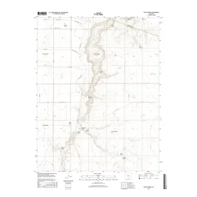
2016 Map of Capps Springs
USGS Topo · Published 2016About this map
The Cucharas River carves a deep path through the high plains of southern Colorado, defining the border between Pueblo Co and Huerfano Co. This arid ranching landscape is punctuated by numerous family-named landmarks and water sources, including Capps Springs, Keystone Spring, and Vigil Spring. The area's infrastructure reflects a sparse, rural economy, where the Cuchara Ranch Airport and various stock tanks like Turkey Tank and Yoeman Tank serve remote operations. Mineral extraction is evident at the Fisher Pit and Collins Pit, while the topography is dominated by a complex system of drainages such as Emma Paul Canyon, Rattlesnake Canyon, and Bustos Canyon. This survey captures the region as a high-altitude grazing and transit zone, where named roads like Sheeps Crossing Rd and Wilsons Crossing Rd link the scattered reservoirs and natural springs.
Find a feature on this map
56 named features on this map. Tap any name to fly to it.
Don’t see what you’re looking for? This feature index may not catch every label — zoom into the map to look around manually.
Map Details
Editions of this 2016 Capps Springs Map
This is the sole edition of this map. No revisions or reprints were ever made.
Other maps of this area

1891 · Walsenburg
USGS Topo · 1:125,000

1891 · Apishapa
USGS Topo · 1:125,000

1893 · Apishapa
USGS Topo · 1:125,000

1894 · Walsenburg
USGS Topo · 1:125,000

1897 · Walsenburg
USGS Topo · 1:125,000

1897 · Apishapa
USGS Topo · 1:125,000

1900 · Walsenburg
USGS Topo · 1:125,000

1954 · Trinidad
USGS Topo · 1:250,000

1955 · Trinidad
USGS Topo · 1:250,000

1958 · Trinidad
USGS Topo · 1:250,000