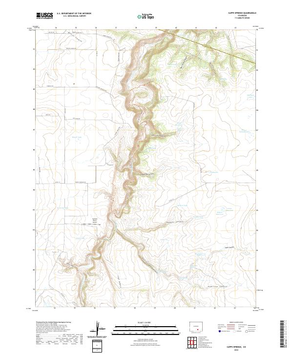
2022 Map of Capps Springs
USGS Topo · Published 2022About this map
The Cucharas River carves a deep path through the center of this landscape, followed by the Cucharas Canyon Trl. This drainage system defines the local topography, creating a network of secondary ravines including Bustos Canyon, Keystone Canyon, and Rattlesnake Canyon. Cattle ranching and water management are the primary human imprints on the land, evidenced by numerous man-made water sources like Wyatt Reservoir, Goodrich Tank, and Salyers Reservoir. These features, along with natural points such as Capps Springs and Vigil Spring, indicate the vital importance of water rights in this arid Huerfano County territory. Transportation is limited to a sparse grid of rural routes like Wilsons Crossing Rd and Sheeps Crossing Rd, while the Cuchara Ranch Airport provides a remote aerial link for the surrounding ranchlands.
Find a feature on this map
58 named features on this map. Tap any name to fly to it.
Don’t see what you’re looking for? This feature index may not catch every label — zoom into the map to look around manually.
Map Details
Editions of this 2022 Capps Springs Map
This is the sole edition of this map. No revisions or reprints were ever made.
Other maps of this area

1891 · Walsenburg
USGS Topo · 1:125,000

1891 · Apishapa
USGS Topo · 1:125,000

1893 · Apishapa
USGS Topo · 1:125,000

1894 · Walsenburg
USGS Topo · 1:125,000

1897 · Walsenburg
USGS Topo · 1:125,000

1897 · Apishapa
USGS Topo · 1:125,000

1900 · Walsenburg
USGS Topo · 1:125,000

1954 · Trinidad
USGS Topo · 1:250,000

1955 · Trinidad
USGS Topo · 1:250,000

1958 · Trinidad
USGS Topo · 1:250,000