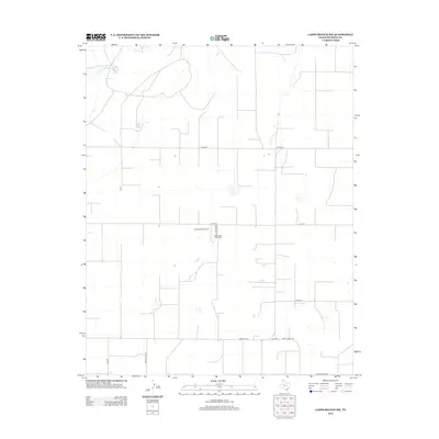
2012 Map of Capps Switch NW
USGS Topo · Published 2012About this map
Sherman County ranching and agriculture are the primary features of this high plains landscape. The influence of the Cluck family is prominent across the territory, visible in the industrial scale of the Dean Cluck Feedyard and the private Cluck Ranch Airport located off Cluck Ave. The land is organized by a strict grid of county roads, including Co Road U and Cord W, which service the sprawling agricultural plots typical of the Texas Panhandle. In the northwest corner, the natural drainage of Coldwater Cr provides a break in the geometric regularity of the terrain. Transportation through the area is anchored by state-maintained routes such as Farm Rd 1573 and Fm-1060, which connect these remote operations to larger regional hubs.
Find a feature on this map
13 named features on this map. Tap any name to fly to it.
Don’t see what you’re looking for? This feature index may not catch every label — zoom into the map to look around manually.
Map Details
Editions of this 2012 Capps Switch NW Map
This is the sole edition of this map. No revisions or reprints were ever made.
Other maps of this area

1954 · Perryton
USGS Topo · 1:250,000

1958 · Perryton
USGS Topo · 1:250,000

1972 · Capps Switch
USGS Topo · 1:24,000

1972 · Sunray
USGS Topo · 1:24,000
1974 · Capps Switch SE
USGS Topo · 1:24,000

1974 · Stevens SE
USGS Topo · 1:24,000

1974 · Sunray 1 SW
USGS Topo · 1:24,000

1974 · Sunray 1 SE
USGS Topo · 1:24,000

1974 · Capps Switch NW
USGS Topo · 1:24,000
1974 · Pleasure Pond
USGS Topo · 1:24,000